Keep Victoria Falls Wild
Current Threats
Victoria Falls City Council (Zimbabwe)
Road Loop Development Area
Road Loop Developments (2024)
Wildlife Corridor (2024)
UNESCO Implications
Road Loop Developments (2024)
The 2024 Victoria Falls City Council Master Plan 'preferred option' map (VF/MP/01, VFCC, November 2024a), identifies the Council-controlled area within the road loop on the approach to the Victoria Falls as a new tourism development zone.
This area, stretching from below the now closed Kingdom Hotel down to the Rainforest visitor car park, was previsouly identified under the 1975 Outline Plan as 'restricted permanently' from development (and identified as Area 14 under the 2001 Combination Plan).

Map showing new council development areas within the railway and road loops down to the Falls (Adapted from VFCC, 2024)
[click image for larger view].
A second map (VF/MP/02, VFCC, November 2024b), showing the central Victoria Falls City business district also identifies this area as managed for tourism, yet details 'Building Operations Permanently Restricted' - significantly the only acknowledgement of any of the 'permanently restricted' areas identified under the 1975 Outline Plan within the new 2024 Master Plan documents.

Map showing proposed enlarged section of central Victoria Falls City Council controlled area. (VF/MP/02, VFCC, November 2024b)
[click image for larger jpg version - 1.15mb].
The area adjoins the Victoria Falls National Park and World Heritage Site (HESZ) along its south-eastern edge. The entire area falls within the 500m Buffer Zone which surrounds the World Heritage Site.
Wildlife Corridor (2024)
The Victoria Falls City Council 2024 Council Master Plan Draft Report of Study (VFCC, April 2024) identified this area as one of three key wildlife movement corridors.
The Report further clarified in several additional statements that development pressures were directly impacting on wildlife movement with implications for human-wildlife conflict and emphasised the need to recognise and respect wildlife corridors in reducing people-wildlife conflict.
“Tourism and residential developments are affecting wildlife corridors and dispersal areas and this has a knock-on effect with human-wildlife conflict.” (VFCC, April 2024, p.155)
“As restrictions of wildlife movement increase the potential for human-wildlife conflict increases significantly.” (VFCC, April 2024, p.91)
“Need for Management of Wildlife and Human conflict - the Master Plan must recognise and accommodate wildlife corridors.” (VFCC, April 2024, p.204)
The 2024 Victoria Falls City Council Master Plan 'prefered option' map (VFCC, November 2024a) shows an expansion of the tourism development zone within this area.
The Council's plans to develop this area, together with riverside tourism stands (such as the Victoria Falls Resort proposal, 'Stand 1815', the Big Tree Area and Railway Loop), combined with National Park plans to develop the Elephant Hills riverine fringe for tourism under the Six Senses 'tree lodge' proposal, appear to be in direct conflict with the warnings and recommendations in the Council's own Report. Development of these areas can be predicted to lead to significant displacement of local elephants from traditional refuge areas and movement corridors, with a corresponding increase in people-wildlife conflict on both sides of the river the most likely consequence.
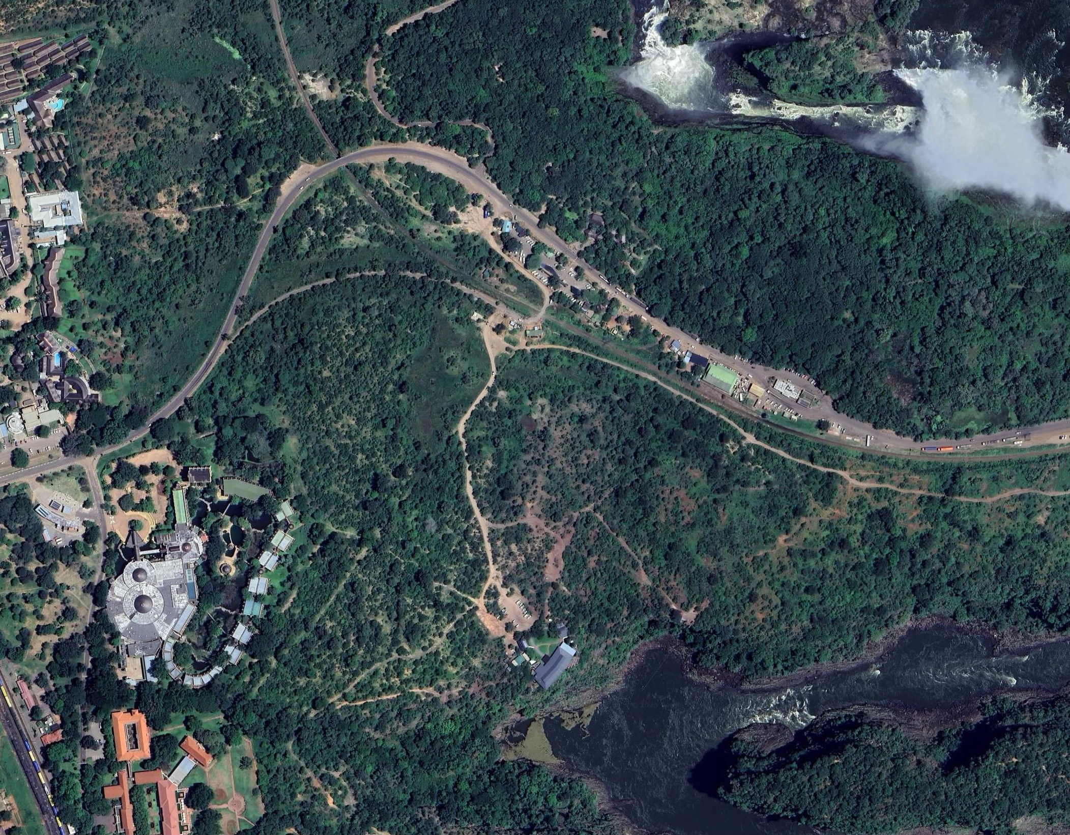
Area of the 'road loop' (2025) [click image for larger view].
UNESCO Implications
While the stand is located outside of the Victoria Falls National Park and World Heritage Site, it is located within the 500m Buffer Zone which surrounds the WHS. It is therefore a notifiable development and any development of this stand needs a detailed EIA to be submitted to UNESCO for comment before being approved.
Google maps: - (external link, opens in a new window).
References
Links to external sites or pdf downloads, open in a new window.
Victoria Falls City Council (April 2024) Victoria Falls City Master Plan. Draft Report of Study. April 2024. (pdf download [34.3 mb], opens in a new window).
Victoria Falls City Council (November 2024) Victoria Falls City Master Plan. Written Statement. June 2024. (pdf download, opens in a new window). With Main Map (Preferred Option VF/MP/01, undated) and Supporting Map VF/MP/02 (undated) (insert section)